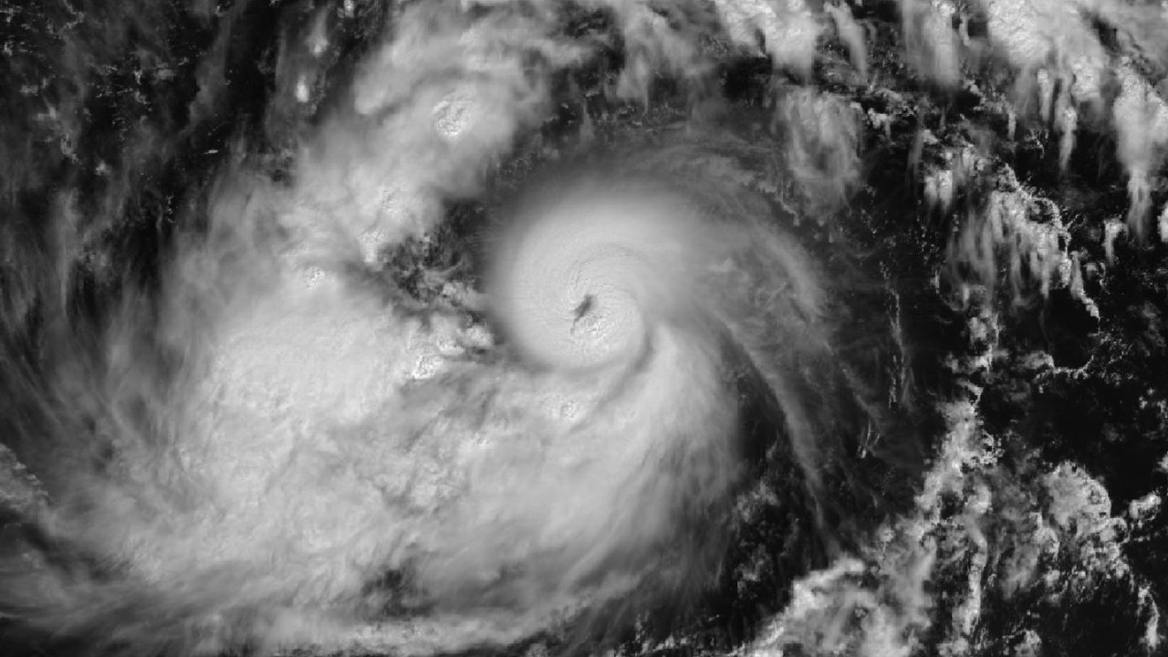
Typhoon Champi strengthened sharply on Saturday evening, Guam time, as it closed on the U.S. territory, according to the National Weather Service (NWS) office in Tiyan, Guam. In Advisory No. 12, issued at 7:25 PM ChST Saturday, Oct. 17 (2:25 AM PT Saturday), the NWS states: “Typhoon Champi upgraded to a dangerous Category 4 typhoon.” The advisory places the center near 12.6N 146.7E at 7:00 PM ChST, about 140 miles east-southeast of Guam and 145 miles southeast of Rota, moving west at 15 mph, with maximum sustained winds of 130 mph. It says the general forecast track “will take Champi just south of Guam as a strong Category 4 typhoon.” It adds that Champi “is forecast to continue intensifying through the next few days, possibly becoming a Super Typhoon within the next 12 hours.”
The jump came fast, by the NWS’s own numbers. Its Intermediate Advisory 11A, issued at 4:48 PM ChST, gave maximum sustained winds of 100 mph at 4:00 PM ChST, with the center about 175 miles east-southeast of Guam, and still forecast that Champi would become “a Category 3 typhoon prior to its passage.” Three hours later, Advisory No. 12 put the winds 30 mph higher and widened the typhoon-force wind field from 40 miles to 60 miles from the center; tropical-storm-force winds still reach up to 125 miles in both products. This desk’s previous Champi story, built on Advisory No. 11 (1:06 PM ChST), reported 100 mph and a Category 2 rating.
The warnings stay the same in Advisory No. 12: a Typhoon Warning for Guam, Rota and the adjacent waters, and a Tropical Storm Warning plus a Typhoon Watch for Tinian and Saipan. The advisory says typhoon conditions, including winds of 74 mph or more, should arrive by Sunday morning, with tropical-storm-force winds arriving “within the next few hours.” It lists an intermediate advisory at 11:00 PM ChST Saturday (6:00 AM PT Saturday) and the next full advisory at 2:00 AM ChST Sunday (9:00 AM PT Saturday).
Local reporting adds timing. The Pacific Daily News, in a running update by Skyler Obispo last headed 8:20 PM ChST, reports that the NWS put Champi’s closest point of approach at around 4:00 AM ChST Sunday (11:00 AM PT Saturday), a time the NWS said always remains subject to change, and that the storm could pass over the southern tip of Guam or just south between 4:00 and 6:00 AM ChST. The paper says Champi could become a super typhoon with around 150 mph maximum sustained winds before its passage, defines super typhoons as storms with sustained winds of 150 mph or greater, and says forecasters expect the worst conditions over the southern half of the island. “This is a dangerous and potentially life threatening storm,” the NWS wrote in a 7:18 PM ChST report, according to the paper.
The paper’s earlier entry, from 5:51 PM ChST, reports that NWS meteorologist David Decou said Champi had intensified over the last hour, and that wind measurements at A.B. Won Pat International Airport had picked up damaging gusts beyond 42 mph, though sustained damaging winds had not registered just before 6:00 PM ChST; Decou expected those winds at around 8:00 PM ChST, the Pacific Daily News reports. That entry gives the storm’s forward speed as 12 mph, while Advisory No. 12 gives 15 mph; this desk has not reconciled the two figures, which may reflect different observation times. The 8:20 PM entry also lists, as of the NWS report it cites, 8 to 14 inches of rain on Guam and peak winds of 110 to 135 mph with gusts up to 175 mph, without saying whether those figures describe forecasts or measurements.
The Joint Typhoon Warning Center (JTWC) in Pearl Harbor gives a higher wind figure than the NWS for 4:00 PM ChST. In Warning No. 12, it gives maximum sustained one-minute winds of 115 knots gusting to 140 at 4:00 PM ChST Saturday (11:00 PM PT Friday), with a minimum central pressure of 948 millibars, and places the storm about 158 nautical miles east-southeast of Andersen Air Force Base at 7:00 PM ChST (2:00 AM PT Saturday). It forecasts 130 knots gusting to 160 at 4:00 AM ChST Sunday (11:00 AM PT Saturday) near 13.0N 144.8E, and a peak of 140 knots gusting to 170 from 4:00 PM ChST Sunday through 4:00 AM ChST Monday, at forecast positions west and west-northwest of Guam. By this desk’s conversion, 115 knots comes to about 132 mph, 130 knots to about 150 mph and 140 knots to about 161 mph. JTWC gives a maximum significant wave height of 38 feet at 4:00 PM ChST Saturday, a figure for the storm’s seas, not the coast.
Sources seem to differ on whether the center crosses land. NWS Advisory No. 12 forecasts a track just south of Guam. Stars and Stripes, in Pacific Storm Tracker entry No. 13 by Dave Ornauer, posted at 7:30 PM ChST, says JTWC’s latest track shows Champi clipping the southern edge of the island and projects it to “rumble over southern Guam just before sunrise Sunday” as a Category 4-equivalent super typhoon with 150 mph sustained winds and 185 mph gusts at the center. The Stripes entry also says that at 4:00 PM ChST Champi packed 130 mph sustained winds and 160 mph gusts, crediting the National Weather Service; the NWS’s own 4:00 PM ChST figure in Intermediate Advisory 11A reads 100 mph, and the NWS gave 130 mph only in Advisory No. 12, for 7:00 PM ChST. This desk flags that gap without resolving it.
The latest Guam government release this desk read predates the Category 4 rating. The Joint Information Center’s Release No. 8, posted at 5:47 PM ChST (12:47 AM PT Saturday), about 100 minutes before Advisory No. 12, says Guam remains in Condition of Readiness (COR) 1 as of 1:00 PM Saturday and tells residents to stay inside a sturdy, concrete-reinforced structure until COR 4. It warns: “Do not go outside during the storm, even if conditions temporarily appear calm.” It says Joint Region Marianas and its installations moved to TCCOR 1 at 3:00 PM ChST, and that Champi should pass “just south of or over southern Guam late Saturday evening into Sunday morning”; the release adds that all of Guam should expect Category 3 typhoon-force conditions of 111 to 129 mph sustained, with possible gusts of 140 to 164 mph. It tells residents of coastal and flood-prone areas in southern villages to evacuate to safe shelter and says: “Life-threatening coastal flooding is expected.”
Release No. 8 also lists shelter numbers as of 5:00 PM ChST: Machananao Elementary School held 216 people against a maximum capacity of 334; Maria A. Ulloa Elementary School, 200 of 349; Astumbo Elementary School, 247 of 287; George Washington High School, 38 of 683; Talofofo Elementary School, 21 of 311; and Inarajan Middle School, which opened at 2:00 PM ChST, 12 of 352. The Pacific Daily News totals those figures at 734 people and a combined capacity of 2,316. The release says the Guam Power Authority (GPA) does not plan to shut down the islandwide power system, that outages may occur automatically when circuits or feeders take damage, that crews will stand down when conditions turn unsafe, and that people should stay away from downed lines, which may remain energized.
The NWS spelled out the stakes in its most recent local statement this desk could retrieve, issued at 3:06 PM ChST, when Champi still rated Category 2. It forecast north to northeast tropical-storm-force winds of 50 to 70 mph with gusts to 100 mph developing into the night, then typhoon-force winds of 110 to 130 mph with gusts to 160 mph by sunrise Sunday, with the closest point of approach over Cocos Island in southern Guam. It says: “Devastating damage will occur.” The statement warns that island-wide power loss could last “potentially for days or weeks,” that water outages may follow if power outages continue, that breaking waves of 30 to 35 feet look likely by early Sunday along shores directly exposed to the center, and that it expects coastal inundation of upwards of 5 to 7 feet, especially along eastern and southern exposures. A Flood Watch covers all of Guam and the Northern Marianas, it says.
No source this desk read reported injuries or structural damage on Guam; the closest approach, early Sunday local time (late Saturday morning PT), still lay ahead when these products went out. Reading note: this desk wrote from NWS Guam Advisory No. 12, Intermediate Advisory 11A and the 3:06 PM ChST local statement, JTWC Warning No. 12, GHS/OCD JIC Release No. 8, two Pacific Daily News updates and the Stars and Stripes Pacific Storm Tracker, not field reporting. The Associated Press also covered Champi alongside Hurricane Trudy, but its page returned a Cloudflare challenge to this desk, so this desk did not use it. The NWS and JTWC give peak winds in different units and averaging periods, and the government release predates the Category 4 upgrade. Residents should follow the NWS in Tiyan and GHS/OCD, not this summary.
