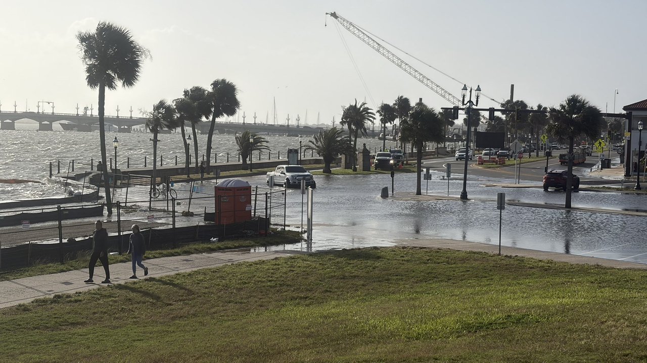
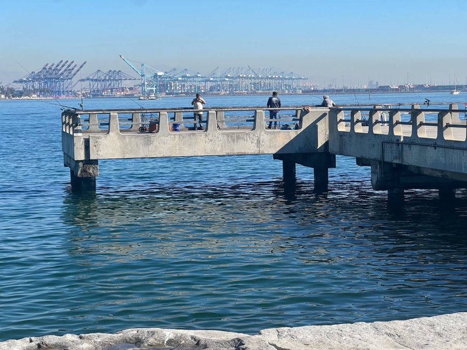
Seawater poured into streets on both coasts of the United States on Monday, Oct. 26, as a full-moon king tide stacked on top of unusually warm water and onshore winds, according to forecasters and local officials quoted by several outlets. In Southern California, the tide gauge at San Pedro in Los Angeles Harbor set a new all-time high. “The preliminary observations at the San Pedro tide gauge reported 8.02 feet this morning, which is an all-time record (records going back to November 1923),” the National Weather Service office in Los Angeles wrote on X at 10:11 a.m. PT. “The previous record was 7.93 feet set on 01/10/2005. Slightly higher tides are possible tomorrow.” (NWS Los Angeles on X).
The federal data behind that post show the same peak. This desk downloaded NOAA’s preliminary six-minute water-level readings for the station, which NOAA lists as 9410660, Los Angeles; the highest Monday value, 8.023 feet above mean lower low water, came at 9:36 a.m. PT, and NOAA marks the data as preliminary, not yet verified (NOAA CO-OPS data). MyNewsLA, citing the weather service, also calls the 8.02-foot figure a preliminary reading (MyNewsLA). USA Today describes the peak as “just above 8 feet” and gives the same 7.93-foot 2005 record (USA Today).
Newport Beach took the worst of the flooding in Orange County. The Los Angeles Times reports that as the tide peaked Monday morning, water surged from Newport Harbor onto the streets of the Balboa Peninsula and flooded some businesses in the Balboa Fun Zone, while Long Beach residents reported flooding along Bayshore Beach, Naples and the Peninsula (Los Angeles Times). ABC7 reports that the water came in from the bay side of the peninsula despite sandbags, and that officials put the Monday high tide at about 8.3 feet, more than a foot above the prediction (ABC7). The Times describes the 8.3-foot level as nearly two feet higher than the tide alone would produce (Los Angeles Times).
Officials credit preparation for limiting the damage. “We saw about 25,000 sandbags go this weekend,” Newport Beach spokesperson Georgia Rios told the Los Angeles Times. “We really saw the community come out.” The Times reports that crews pumped out knee-high water and reinforced sandbags along the harbor side of the peninsula, and that officials had received no reports of significant widespread damage (Los Angeles Times). MyNewsLA quotes Katrina Foley, vice chair of the Orange County Board of Supervisors: “The city has built up a giant berm and the county has been working with the city to distribute sandbags” (MyNewsLA).
Watch: the king tide on both coasts
Two videos posted on X Monday morning show the water in Newport Beach and in Fort Lauderdale. This desk has not frame-checked either clip. If an embed does not load, it shows as a plain link.
View the @Surflick post on X
View the @GavinValenti post on X
In Long Beach, ABC7 reports that the tide rolled over sand berms at Bayshore Beach and across 54th Place toward waterfront homes and businesses, and that water filled a garage below sea level where a restored 1968 Volkswagen Beetle sat parked. “All of a sudden, that water just came in, and I went to open the car and the water started going in the car. So I just closed the door,” Annie Koury told the station (ABC7).
Forecasters expect more. Newport Beach police put Tuesday’s expected tide at 8.5 feet, NBC Los Angeles reports, and the Los Angeles Times, citing the weather service office in Oxnard, reports projected harbor levels of 8.1 feet Tuesday and 8 feet Wednesday (NBC Los Angeles; Los Angeles Times). A coastal flood warning covers the whole Orange County coastline and an advisory covers the Los Angeles County coastline until 1 p.m. Thursday, according to MyNewsLA and ABC7 (MyNewsLA; ABC7). The Times adds that the warning also covers San Diego County, with an advisory farther north in Ventura, Santa Barbara and San Luis Obispo counties (Los Angeles Times). Metrolink suspended Orange County Line trains between the Laguna Niguel/Mission Viejo and Oceanside stations through Friday, NBC Los Angeles reports (NBC Los Angeles), and Huntington Beach said it would close Pacific Coast Highway between Warner Avenue and Anderson Street from 8 a.m. to noon Tuesday, according to ABC7 (ABC7).
San Diego County came close to its own mark. In La Jolla, the Los Angeles Times reports a level of 7.75 feet and quotes Chandler Price of the weather service in San Diego: “That’s very close to the record at the station, which is 7.81 feet.” USA Today, citing preliminary NOAA data, puts the La Jolla morning high at “at least 7.79 feet” (Los Angeles Times; USA Today). Neither outlet reports a new record there.
Why so high? Bob Oravec, a meteorologist at the weather service’s Weather Prediction Center, told USA Today that the full moon converged with warmer-than-normal water, El Niño, offshore storms and an underwater Kelvin wave that raised sea levels along the Pacific coast (USA Today). The Los Angeles Times reports that record-hot ocean water off California leaves seawater 1.25 to 1.8 feet above the astronomical tide, citing scientists, and cites Scripps researcher Reinhard Flick on the 18.6-year lunar node cycle and 4.4-year lunar perigee cycle, both near their peaks (Los Angeles Times). Erika Spangler of the Union of Concerned Scientists said in a statement quoted by USA Today that the levels forecast for Florida equal, under most sea level rise scenarios, what could become normal later this century (USA Today).
On the Atlantic side, strong onshore winds pushed the water higher still. Miami’s record on Oct. 25 marked the fourth in five days and ranks as the fifth-highest tide at the gauge, Brian McNoldy of the University of Miami’s Rosenstiel School told USA Today, adding that the streak could reach “an unprecedented 10 days”; the paper reports that the highest tide of the event should arrive Tuesday morning (USA Today). The South Florida Water Management District lists Oct. 27 as the annual maximum predicted peak for the east coast and says some locations approach the weather service’s “Major Flooding” threshold (SFWMD). NBC 6 reports water over parts of the Hollywood Beach Broadwalk and a wind advisory through Tuesday evening (NBC 6 South Florida).
Farther north, CBS12 reports that the Martin County Sheriff’s Office called SW Dyer Point Road in Palm City impassable and sent high-water vehicles, and that Boynton Beach closed the intersection of Ocean Avenue and Federal Highway (CBS12). In Northeast Florida, a weather service forecaster compared the impacts to those of a tropical storm, News4JAX reports, and St. Augustine kept City Hall and several government offices closed until noon (News4JAX). USA Today reports a record non-tropical water level at Port Canaveral, advisories in Florida, Georgia and North Carolina, and an emergency evacuation order for visitors, with no visitors permitted on North Carolina’s Hatteras Island, citing the state Department of Transportation (USA Today).
The numbers carry small gaps across reports. The Los Angeles Times gives the 2005 Los Angeles Harbor record as 7.93 feet in one passage and 7.92 feet in another; the weather service, USA Today, MyNewsLA and ABC7 give 7.93 feet. MyNewsLA and USA Today date the San Pedro records to November 1923, while ABC7 and NBC Los Angeles write 1924 (Los Angeles Times; NWS Los Angeles on X; USA Today; MyNewsLA; ABC7; NBC Los Angeles). This desk follows the weather service’s figures and treats the 8.02-foot reading as preliminary until NOAA verifies it.